
The Application of GIS and Remote Sensing on Assessing Physical Impact Caused by Tsunami on Dec,26 2004 in the Coastal Zone of Thailand
โดย ผู้ช่วยศาสตราจารย์ ดร.สมบัติ อยู่เมือง และทีมงานวิจัย
ศูนย์วิจัยภูมิสารสนเทศเพื่อประเทศไทย [ GISTHAI ] จุฬาลงกรณ์มหาวิทยาลัย
e - mail : sombat@gisthai.org
ByAssistant Professor Sombat Yumuang et al.
Geo-InformaticS Center for Thailand [ GISTHAI ] Chulalongkorn University
 |
|
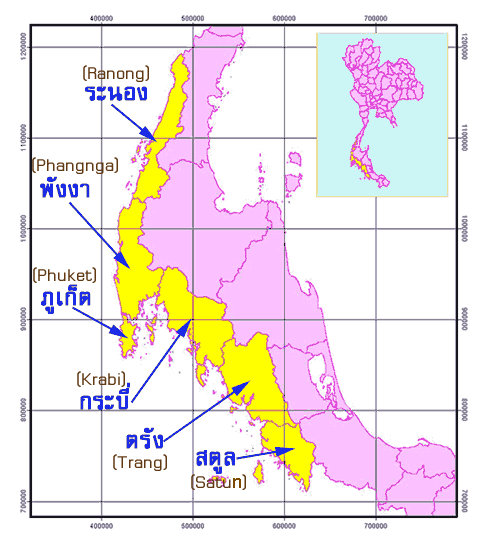
แผนที่แสดงลักษณะภูมิประเทศ ของประเทศไทย บริเวณที่ได้รับผลกระทบจากคลื่นยักษ์ (Tsunami) Topographical map of Thailand in the affected areas by Tsunami |
 |
 |
 |
|
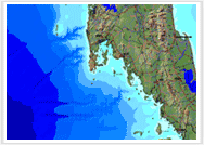
แผนที่จำลองลักษณะภูมิประเทศและ เส้นทางคมนาคมของประเทศไทย Simulated topographical map and transportation network of Thailand |
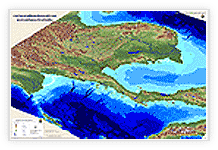
ภาพจำลองสามมิติแสดงลักษณะภูมิประเทศ ของประเทศไทยและบริเวณใกล้เคียง Aperspective view showing Thailand topography and the surrounding areas |
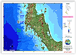
แผนที่แสดงเขตอุทยานแห่งชาติ The boundary map of National Park |
|
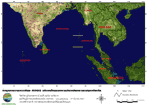
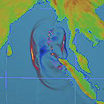
แผนที่แสดงข้อมูลการเกิดแผ่นดินไหวบริเวณทะเลอันดามัน Map of Earthquake Phenomenon in Andaman Sea |
 |
 |
 |
|
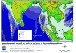
ข้อมูลภาพจากดาวเทียม MODIS บริเวณ โดยรอบทะเลอันดามัน และมหาสมุทรอินเดีย Modis satellite image of Andaman Sea and Indian Ocean |
ข้อมูลภาพจากดาวเทียม MODIS ซ้อนทับตำแหน่งการเกิดแผ่นไหว [26 - 29 ธ.ค. 2547] Modis satellite image overlaid with the point of earthquake (26-29 December 2004) |
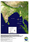
ตำแหน่งการเกิดแผ่นไหว Main Shock และ After Shock ในทะเลอันดามัน และมหาสมุทรอินเดีย [26 - 27 ธ.ค. 2547] The location of earthquake phenomenon and its after shock in Andaman Sea and Indian Ocean (26-27 December 2004) |
|
Download รูป |
Download รูป  |
Download รูป |
|
ได้รับความอนุเคราะห์ข้อมูล : Source of Ikonos satellite images : |
|
|
ข้อมูลเพิ่มเติมเกี่ยวกับแผ่นดินไหว และคลื่นยักษ์สึนามิ (tsunami) more information about earthquake and tsunami |
 www.geophys.washington.edu |
|
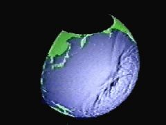
| แบบจำลองแสดงการเกิดสึนามิ (tsunami) |
 |
 |
 |
| Okushiri Island | Field Surveys |
Non-tsunami inundation in China. |
 |
 |
 |
|
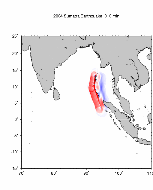
Sumatra Earthquake ( Animation provided by Kenji Satake, National Institute of Advanced Industrial Science and Technology, Japan ) |
Western Indian Ocean / Somalia (National Oceanic & Atmospheric Administration (NOAA)) |
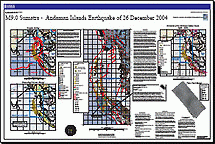
M9.0 Sumatra - Andaman Islands Earthquake of 26 December 2004 http://www.usgs.gov |